It looks like there is a brand new Satellite Map for Altis, which is looking really great and much better than the one before. Excellent work on that! I know how hard it is to get proper image material like this.
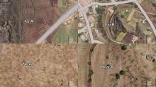
However, since the new Satellite Map is different than the one before, the splat maps do not match it anymore. Thus the color and texture of the terrain can change completely from long to near distance views, which might confuse pilots or long distance travelers.
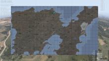
Also, the new Satellite Map seems to be darkened in the map UI. Not sure if this is wanted behavior.
I am aware of the amount of work required to get a perfect result, so I do not expect adjustments in the near future. See this as a reminder ticket :)

